CONTENT
MOUNTAINEERING TRAILS ARE MARKED WITH THE KNAFELC BLAZE
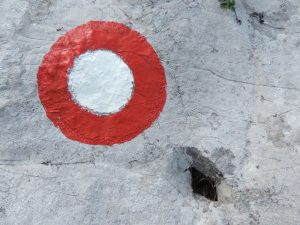
Slovenia boasts just over 10,000 km of trails, all of which are marked with the Knafelc blaze, a white dot inside a red ring. It’s between 8 and 10 cm in diameter, and the ratio between the red ring and the white dot (in the cross-section) is 1:2:1. It may also have a number or letter next to it, marking long-distance trails such as the Slovenian Mountain Trail (indicated by the number 1).
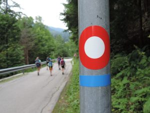
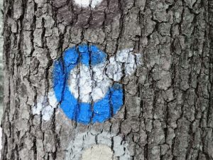
Other blazes are used in Slovenia as well, such as the mountain biking blaze – a white dot inside a blue ring with two white lines (shown in the middle of the left image). There’s also a blaze for multi-purpose trails, which are suitable for both walking and mountain biking, and is indicated by a blue line added to the Knafelc blaze.
You can also find countless other signs marking various thematic, educational, and other trails. But remember, mountaineering trails are marked only with the Knafelc blaze. Blazes with a yellow dot and red ring are also quite common, marking European long-distance paths that cross Slovenia (E6, E7, and E12).


DIRECTIONAL SIGNS, ARROWS, AND LINES
Directional signs provide information about the direction of the destination, the difficulty of the trail, and the walking time. The altitude of the sign is also included, as well as the Alpine Club responsible for the trail. Directional signs on hiking trails are red, while those on mountain biking trails are blue. The estimated walking time (without breaks) is calculated based on distance and total elevation gain or loss. The following numbers are used in the calculations: walking speed on flat terrain – 4km/h, average elevation gain – 300 m/h, average elevation loss – 400 m/h.
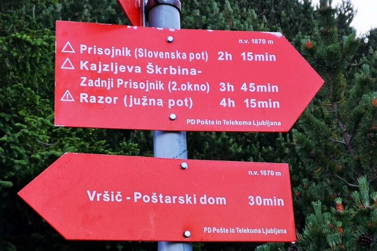
The direction of the trail can also be given with straight or broken red lines. At intersections, they sometimes change into arrows with the names of huts and peaks they lead to.
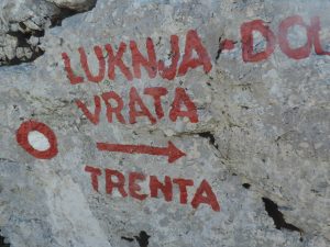
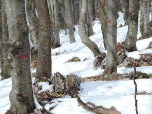
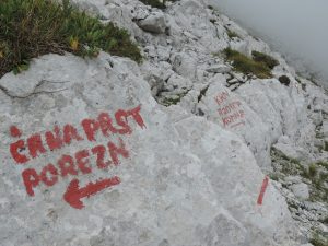
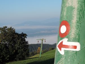
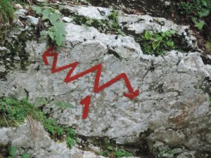
Photo: PZS/Matej Ogorevc
DIFFICULTY LEVEL OF TRAILS
Mountain/hiking trails are categorized into three difficulty levels:
You don’t have to use your hands while walking. Trekking poles can be used. On hiking maps, these trails are marked with a continuous line. They don’t have any special designation on directional signs.

Even easy mountaineering trails can be dangerous. They can lead across steep slopes where a fall could result in serious injury or even death.
Occasional use of hands is required, steel wires and other safety equipment is provided to increase safety. A helmet is recommended. On hiking maps, these trails are marked with a dashed red line, and a triangle is used on directional signs.

Use of hands is mandatory. These trails are equipped with safety equipment (pegs, steel wires, etc.), which, in some cases, may be limited. Some very difficult trails don’t have any safety equipment at all. Safety equipment is used to facilitate upward movement. A helmet is recommended, as well as a harness and Via Ferrata kit (on trails that are suitably equipped). On hiking maps, these trails are marked with a dotted red line, and sections secured with safety equipment are marked with crosses. On directional signs, very difficult trails are marked with an exclamation mark inside a triangle.

Even easy mountaineering trails require hiking boots and possibly a helmet. A technically easy trail can be physically demanding because of steepness, length, or type of terrain.
Via Ferratas are becoming increasingly popular and widespread in Slovenia. They’re classified as adrenaline sports facilities in a natural environment and don’t have the status of mountaineering trails. They’re also not marked with the Knafelc blaze.
Because of their difficulty and exposure, the use of a harness, Via Ferrata kit, and helmet is mandatory. There are many Via Ferratas, especially outside Slovenia, that are extremely demanding, both physically and mentally, and require the ability to climb on rock by using natural hand and footholds.
You can read more about Via Ferratas in the VIA FERRATA FOR BEGINNERS article.
maPZS
 maPZS is an app that makes it easier to plan and carry out trips on any of the 2030 Slovenian trails. It includes information on more than 10,000 km of marked trails, which are maintained by 215 alpine clubs.
All the information provided by the maPZS app is up-to-date as it is automatically synced with the data of the Alpine Association of Slovenia’s register of trails. At home, on your computer, you can use the app’s map to choose an objective in accordance with your preferences regarding length, area, required skills, and time of year.
All the information is also available on your smartphone, which you can use while out on the trail. If you’re heading to an area without a mobile phone signal, you can download the map and all the trip data. This way, they’ll be available offline.
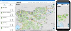
Source: mapzs.pzs.si
You can download the map at the mapzs.pzs.si website. It runs on all personal computers using the most common browsers and on smartphones with Android or iOS operating systems.
The app is free. On your phone, just click the link or type in the following URL: https://mapzs.pzs.si and follow the instructions.
When heading to the mountains, you need more than just a full backpack and fitness; you also need to know the basic trail markings. so you can make the most of hiking maps and the maPZS app.
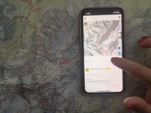 Photo: PZS/Barbara Gradič Oset
You can plan your itinerary using the Triglav hiking map (1:25,000) or with the maPZS app. We recommend using both.
Step 1: maps.pzs.si
At home, download the maPZS app. It runs on all personal computers using the standard browsers and on smartphones with Android or iOS operating systems. If you’re heading to an area without a mobile phone signal, you can download the map and all the trip data. This way, they’ll be available offline.
Step 2: choosing an objective
Enter your objective in the search field. You select Cmir and the app indicates it’s a difficult trail, marked with a dashed line on the map.
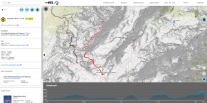
The initial part of the trail is marked with a continuous red line, meaning it’s an easy trail. The app also provides information about the estimated time required for your itinerary.
Step 3: comparing the data from the app with a map
If you’re not a fan of mobile apps and prefer to use traditional maps, compare the app’s recommended itinerary with an up-to-date map at home. You’ll see that the markings and difficulty levels are the same.
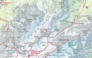
To get to your chosen hut (Dom Valentina Staniča), you’ll already need to walk quite a bit. If you’ve decided to approach the hut via the Tominškova path (a very difficult trail), the app will let you know that it is closed (at the time of writing this article). So you choose another route called Čez Prag, part of which is also very difficult.
… and remember. Despite having the app installed on your phone, keep a printed hiking map in your backpack. It works reliably in all conditions.
If you notice damage on a trail that affects the safety or hikers or could lead to further deterioration of the trail, you can quickly and easily report it using our maPZS app.
Your damage report will be quickly reviewed and forwarded to the alpine club responsible for that trail using the maPZS app. After reporting the damage, trail wardens can perform the necessary maintenance or repairs, limiting the damage and making the trail passable and safe.
Procedure for submitting a damage trail report:
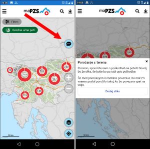
- Step 1: click on the cloud with three dots at the top of the app (red arrow on the bottom left image).
- Step 2: add a photo of the damaged trail (optional).
Source: PZS
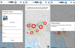
- Step 3: describe the damage and provide your contact details.
- Step 4: provide the location of the damaged trail.
- Step 5: confirm the submission of the damaged trail report.
Source: PZS
IMPORTANT: if there’s no mobile connection when you report the damage, your message will be saved in the maPZS app and automatically forwarded when the connection becomes available.
TRAIL CLOSURES
Natural processes have a significant impact on mountaineering trails. Trails can be damaged and safety equipment can be compromised, which leads to short-term and long-term closures. Based on information provided by trail wardens, the Alpine Association of Slovenia keeps a list of closed trails, published on www.stanje-poti.pzs.si.
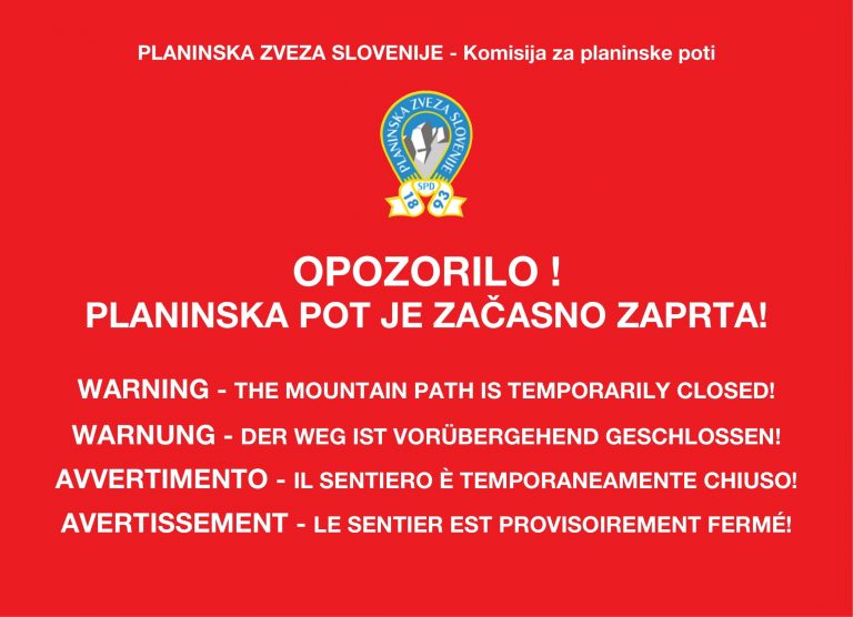
HIKERS USING MOUNTAIN TRAILS ARE ADVISED TO …
… learn about the current state of the trails by checking the website stanje-poti.pzs.si/en by asking at the local mountain hut, or by enquiring at the local alpine club. If you notice any damaged or inadequately maintained parts of a mountain trail (damaged guards, faded trail markings, heavily overgrown trail, rockfalls, etc.), please send email to poskodbe.poti@pzs.si. Please indicate on which mountain trail you noticed the damage, describe the problem, and add a photo, if possible.
WARNING: Mountain hikers use the trails at their own risk. Mountain trail users must behave in a responsible manner so that they do not endanger or hurt themselves or others. A user must use mountain trails in a manner which does not cause any damage to the trail or to the land, property or buildings adjacent to it, nor causes any harm to the flora and fauna along the trail. It is prohibited to restrict access to mountain trails and to damage, remove or destroy trail markings, direction boards, boxes and protective equipment or any other labels. It is also prohibited to use unmarked shortcuts.

