CONTENT
WEATHER IN THE MOUNTAINS IS DIFFERENT FROM THE VALLEYS
Weather and weather phenomena are much more unpredictable in the mountains than in the valleys. Varied terrain, high altitudes with significant differences over short distances, and differences in terrain aspect contribute to rapid changes in temperature, wind, and humidity. It’s no surprise, therefore, that the weather in the mountains changes quickly and phenomena are more intense, last longer, and are more difficult to predict.
But can the weather actually be labeled good or bad? Everything has its pros and cons. So let’s instead think about the weather as more or less suitable for mountain activities.
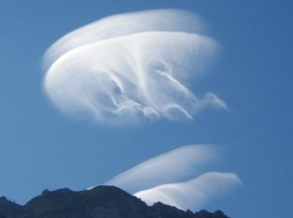
Lenticular clouds are most commonly observed above mountain ridges. They form when strong winds blow perpendicular to a mountain barrier. Warm and moist air is forced to rise, which cools it and causes water vapor to condense and form clouds. When the air descends on the other side of the mountain, it warms up again, causing the cloud to evaporate/disappear. What’s left takes on a lens-like shape, hence the name lenticular clouds. Lenticular clouds are an indication of strong winds on the mountain ridges. Reconsidering a ridge tour in such cases is highly advisable. Photo: PZS/Matej Ogorevc
WEATHER VARIABLES AND PHENOMENA
Weather is the current state of the atmosphere at a certain location and depends on the interplay of several weather variables, the most well-known being temperature, humidity, and air pressure. Most weather phenomena (precipitation, cloudiness, wind strength, etc.) depend on these variables.
Air heats up indirectly from the ground or the surface over which it’s located. The darker the surface, the more the air heats up. That’s why the air in the valleys, where there’s a lot of “dark surfaces” (soil, forests, seas), heats up more than the air in the mountains, where the surfaces are generally brighter (grey rocks, white glaciers). There’s also less surface to heat the air as the angle at which the sunbeams reach the surface also plays an important part.
Warm air rises due to lower density, cooling as it does so, reducing its ability to retain moisture. Under the right conditions, the air can cool to the point where water, which was previously in the gaseous state, condenses – transitions into the liquid state. This forms a cloud composed of tiny droplets. If the cloud reaches the ground, we start talking about fog. If there’s a lot of moisture in the air, the droplets grow until they become heavy enough that the rising air forces can no longer hold them in the air. That’s when it starts to rain or snow in the winter.
The process of cloud formation is even more pronounced in the mountains. Here’s classic Slovenian example: moist air brought by the south wind from the Adriatic Sea eventually hits Trnovski gozd or the Julian Alps, where it’s forced to rise. It does so at a considerable speed, making the temperature drop even more pronounced. The moisture in this air (which it has “collected” over the sea) quickly condenses, resulting in clouds full of heavy droplets. That’s why it so often rains in Bohinj – the ridge of the Bohinj-Tolmin mountains is the first major obstacle the air encounters on its “way north”. Such precipitation is called orographic.
Clouds can also form differently in the warmer part of the year. Due to the strong sun, the surface heats up quickly and intensely, as does the air above it. Consequently, this air rises very quickly, cooling rapidly and condensing as it rises. Since the rising of the air is so strong, the droplets don’t fall to the ground but keep growing, as does the cloud. Such clouds (Cumulonimbus) have a distinct “cauliflower” shape. If you see one of these clouds nearby, it’s wise to start thinking about possible retreat options, especially if you’re on an exposed ridge. These are the clouds that bring summer storms, which should be feared because of strong winds, heavy rain, and especially lightning strikes, which can be deadly.
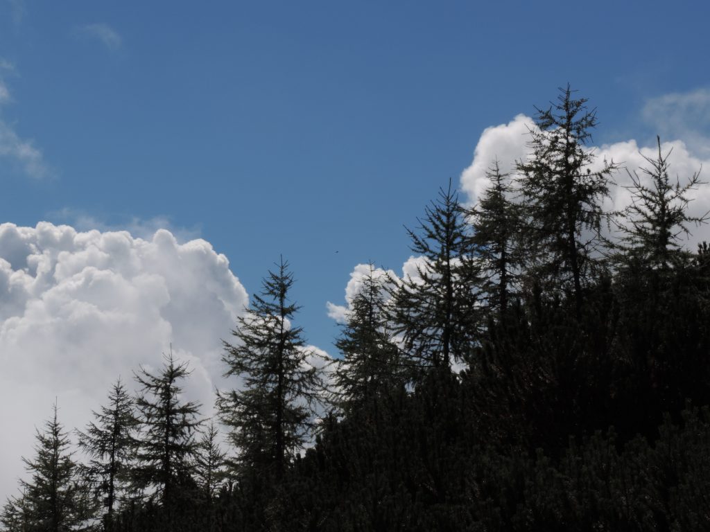
Cumulus, cauliflower-shaped clouds – harbingers of thunderstorms and hail. Photo: PZS/Matej Ogorevc
Development of a typical summer storm. Source: Youtube, channel kjoenbongarit
Air pressure also decreases with altitude and changes depended on the location on Earth. Related to this are areas of high air pressure (anticyclone) and low air pressure (cyclone). It’s important to know that anticyclones bring (prolonged) nice weather (with the exception of summer thunderstorms), while cyclones lead to rainy weather. As a rule of thumb, dropping air pressure at a certain location indicates that bad weather is on its way.
Winds are also caused by differences in air pressure. Air “flows” from a region with high air pressure to a low-pressure region. Air is a fluid (physically speaking), but it’s invisible due to its gaseous state. We feel it’s movement, however, in the form of wind. Because of the effects of Earth’s rotation around its axis and the Sun, wind doesn’t blow directly towards the center of the low-pressure area, but perpendicular to it with the cyclone’s center to its left.
From the valley, strong winds in the mountains are difficult to recognize. In winter, s sure sign is snow forming so-called flags on ridges and peaks, while in summer, lenticular clouds are an indicator of strong winds. They form when strong winds blow over mountain ridges and peaks, forming clouds with a distinct lens-like shape (Altocumulus lenticularis). As the air descends on the lee side of the mountain, it warms and the droplets turn back into vapor. These clouds often make rows parallel to ridges because the air can rise several times due to inertia.
An air mass picks up the characteristics of the area it sits over – the air mass above Siberia is cold and dry, for instance, while the air mass over the Indian Ocean is warm and moist. Weather fronts from at the boundaries where these air masses mix and the type of the front is determined by how they mix.
A cold front forms when a cold air mass rapidly displaces a warm air mass. The air rises, condenses, and clouds form. Since this rise is rapid and powerful, it results in heavy precipitation, including thunderstorms. Temperature drops quickly and strong winds are present. Cold fronts are short-lived, usually passing over in a few hours. Cold fronts are the reason for summer snowfall in the mountains.
In a warm front, warm air pushes towards a cold air mass, sliding onto it and rising in the process. The associated phenomena are less intense than in cold fronts. The rain isn’t heavy and temperature remains relatively high. The passage of a warm front takes longer, up to several days.
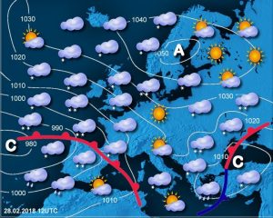
Source: Agencija Republike Slovenije za okolje (Slovernian Environment Agency)
On a weather map, a cold front is marked with blue lines, and a warm front with red lines. The letter “C” indicates a low-pressure area (cyclone), and the letter “A” indicates a high-pressure area (anticyclone). The white lines are isobars, lines connecting points on the Earth’s surface with equal air pressure.
VPLIV VREMENA NA PLANINCE
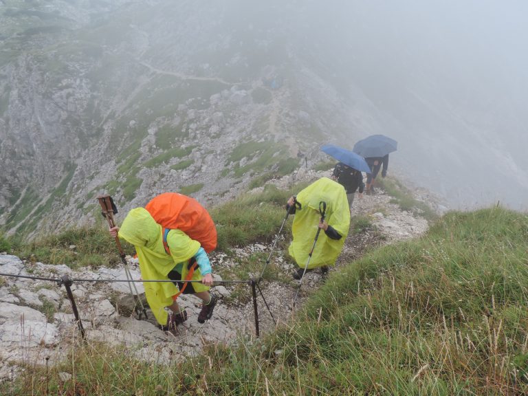
In rain and wind, the body cools much faster than in dry weather. Proper protection is vital. Photo: PZS/Matej Ogorevc
It’s a well-known fact that low temperatures can cause hypothermia, which can be fatal. And let’s not forget about frostbites either, which are not limited to Himalayan giants. Severe frostbites, which can lead to amputations, also occur in Slovenian mountains. That’s why it’s crucial that in cold (and wind), all peripheral parts of the body (extremities, nose, ears, fingers) are well protected from the cold and wet clothing (gloves, socks) are regularly changed.
But high temperatures can also be dangerous for a human body. Heatstroke (overheating of the body, which can no longer cool down effectively) can also occur in the mountains. In extreme cases, a heatstroke can be fatal, so quick action is required: getting the person into shade as soon as possible.
Sunstroke (overheating of the head leading to increased intracranial pressure) can also occur in the mountains. It can be prevented by moving into shade and cooling the head with cold compresses).
High temperatures also pose indirect dangers – the sun melts the snow and if the snowpack becomes too saturated, glide avalanches can occur, cornices can collapse, and glacier bridges can break. In wet and heavy snow, progress is more difficult, requiring more time and energy, which is why you’ll need more food and drink, which makes your backpack heavier and your progress even slower.
In sunny weather, you must be wary of solar UV radiation. In summer and in the snowy white landscape of winter, protect your skin using high-factor sunscreen or light long clothing. If your skin is protected with sunscreen, your eyes should be protected with sunglasses. Without them, your eyes can be damaged, causing snow blindness. Although snow blindness is usually temporary, long-term exposure to bright sunlight and its reflection from the snow can cause long-term damage.
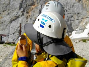
Sunscreen, lip balm, sunglasses, a hat, and light long clothing are the only effective protection against the strong mountain sun. Photo: PZS/Matej Ogorevc
Strong winds can be very dangerous in the mountains, even fatal. Walking in strong and gusty winds is difficult and the risk of falling is high.
We cool down faster in the wind – it constantly blows away the thin layer of warm air on our skin, which is an excellent insulator. Only the best clothing can protect us from the wind, so it’s a very good idea to invest in a high-quality jacket. Combined with cold weather, wind is even more dangerous.
Wind transports snow, creating snowdrifts, cornices, and slabs. A slab is a wind-compacted layer of snow on the surface of the snowpack. A weak layer of soft snow is hidden underneath, which provides an excellent sliding surface when the bonds in the snowpack break down. Even the most experienced mountaineers have trouble identifying slabs.
Wind is often even stronger in exposed areas such as ridges, summits, and saddles. Strong and gusty winds are particularly dangerous, as gusts often surprise us and, if strong enough, can cause us to fall, which can be fatal, especially on ridges.
Visiting high mountains in wet and rainy weather is not recommended. Bones of many legs, arms, and heads gave given way to slips and sudden contacts with rock. This happens even sooner if rain falls on a cold surface, forming a thin, almost invisible layer of ice – verglas. Not even the best crampons can help you such conditions!
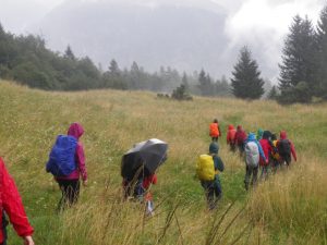
Precipitation can’t be overlooked. With the right objective, hiking in the rain is perfectly possible. Although views may be lacking, lower, unexposed objectives can still be more than adequate for a wet training hike. Photo: PZS/Matej Ogorevc
WEATHER FORECASTS
Weather forecasting is a complex mathematical process. No weather forecast is completely accurate, as there are simply too many variables that influence the weather and even the smallest deviation can lead to a change in the weather. That’s why it’s crucial that you consult a weather forecast from a reliable source before heading out. Trust the information from national meteorological services rather than instant forecasts with a couple of images found on various websites.
In Slovenia, ARSO (National Meteorological Service of Slovenia) provides numerous and various forecasts.
ARSO’s basic weather forecast (available only in Slovene) provides information about the weather for the next ten days for various locations. It’s suitable for non-demanding users. It displays hourly forecasts with graphical symbols, and the extended view provides wind strength with gust speeds, relative humidity, cloud base height, and precipitation amount forecasts.
Between 7 AM and 5 PM, you can call 090 71 30 or 090 93 41 to talk to the on-duty meteorologist. You can also listen to the forecast on the answering machine at 090 93 98 22. All calls are chargeable and the price depends on the mobile service provider.
Note: the on-duty meteorologist isn’t available during radio broadcasts, while recording the answering machine forecasts, and when overwhelmed with work.
ARSO’s Aladin is a regional meteorological model for weather forecasting. It’s a model that calculates weather using mathematical and physical equations. Meteorologists then interpret the results provided in the form of numbers and graphical displays to create text forecasts. Aladin is considered an accurate model, especially since it provides meteorologists with a detailed overview of locally limited phenomena such as storm systems, regional winds, bora wind, storm squalls, etc.
For mountain excursions, ARSO’s mountain weather forecast is particularly useful, complemented by their ski resort forecast (updated and useful in summer as well). Both forcasts are available in Slovene language only.
During the winter, or rather the snowy part of the year, ARSO issues an avalanche bulletin (only in Slovene) several times a week.
As part of the Crossrisk project, a simple, user-friendly, and clear platform was launched that provides information about avalanche conditions in Slovenia and the Austrian lands of Carinthia and Styria, which is also an extremely useful tool. Crossrisk is available in English and German as well.

