CONTENT
We recommend that all inexperienced mountain-goers hire a mountain guide.
BEFORE THE TRIP
- Ask yourself whether you’re physically and mentally ready. Is the chosen route suitable for me and my company?
- Check the weather forecast. Bad weather and reduced visibility can significantly extend the timer required to finish your trip. Do I have the right clothing to protect me from strong winds, cold, and rain? Are there any huts, bivouacs, or shelters where I can retreat in case of an emergency?
- Plan your route and go over it in your mind. Divide it into sections, plan rests, and estimate walking times for the ascent and descent. The summit is only the halfway point – the goal is to safely return home!
- Check the terrain and the gradient of the route. Boulders, scree, and dwarf pines can slow you down significantly. Is there a way you can avoid them? Where can you cross narrow cirques, torrents, and steep rock cliffs?
- Try to identify the potential dangers on the route. Weather can influence the terrain (dry, slippery, snowy path), and presence of rock faces above your planned path or steep cliffs below it should influence the choice of route and equipment.
Mountaineering and hiking guidebooks contain descriptions of single or multi-day excursions and tours. Their biggest advantage is their relative objectivity and focus on facts. This is the only way an author can describe tours from start to finish to the broadest public. Guidebooks by the Publishing House of the Alpine Association of Slovenia are reviewed, meaning that the descriptions are verified by experienced mountaineers.
Descriptions contain information about tours, sights and attractions along the way, viewing points, accommodation, restaurants, etc. Most modern guidebooks also include route sketches and map excerpts. Given the large amount of content, it’s recommended to use hiking maps alongside guidebooks.
Many descriptions of routes, peaks, and excursions can be found on websites, forums, and social networks. This isn’t problematic in itself, but the issues lies in highly personal and emotional accounts. Unlike the reviewed and verified descriptions in guidebooks, online posts are “unfiltered”.
To put it more plainly… What is easy for somebody may be almost impossible for someone else. Walking speeds also vary greatly – somebody may reach a certain summit in three hours, while someone else might need an hour less or an hour more. “Macho” behavior, pretence, and conceited neglect of dangers and technically demanding sections of routes, which regularly appear online, can be especially dangerous.
Online descriptions can definitely be useful when planning your route, but you have to take them with a grain of salt. Read as many descriptions as possible and compare them with those in guidebooks and with hiking maps. Photographs can be especially useful, although even they can be misleading.
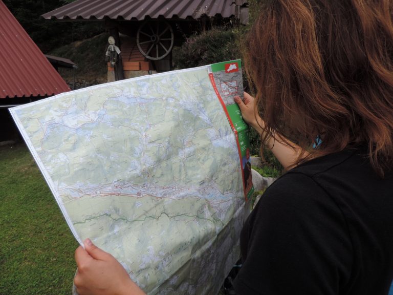
Hiking maps are tailored for mountaineering and hiking and have detailed relief depictions. They feature hiking, mountain biking, and other paths, recommended ski touring routes, mountain huts and restaurants, alpine pastures, peaks, water bodies, vegetation, and natural and cultural attractions.
For hiking on marked trails, hiking maps with a scale of 1: 50,000, which cover a large area, are sufficient. Paths and other mountain infrastructure are depicted clearly enough for planning and navigation.
For those embarking on unmarked trails, as well as ski tourers and alpinists, hiking maps with a scale of 1:25,000 are more suitable. They cover smaller areas but are much more detailed. These maps (along with appropriate knowledge and experience) can be used to thoroughly prepare for off-trail excursions and ski tours as they allow for easier and more accurate navigation and recognition of steep areas, gullies, rock faces, sinkholes, and other (smaller) relief features.
Various online applications can be useful for planning an excursion or tour and navigating while out in the field. However, they have many limitations. Do they have the correct data? How long will your phone battery last, especially in the cold? Is the mobile phone signal in the mountains good enough to transfer data? All these factors and more affect the apps’ functionality.
Only use apps you trust to have accurate data about hiking paths and terrain (Google Maps doesn’t!). Slovenian hiking maps and terrain are correctly depicted in our free mobile app called maPZS. Explore it and use it – but don’t forget: always keep a printed map in your backpack. It works even in the dark and cold.
- Make sure your backpack contains all the necessary personal and technical equipment needed for a safe tour, including enough water and energy-rich food.
- emergency foil blanket and bivy sack,
- first aid kit,
- headlamp and spare batteries,
- fully-charged cell phone,
- note and pencil,
- candle and matches stored in a watertight bag,
- high energy food which is light, long-lasting and doesn’t take up much space (energy bars, nuts, etc.).
Keep in mind that the weather in the mountains can change abruptly (you could easily encounter extreme cold and snow in the height of the summer), so bring a warm layer, hat, and gloves.
Pack a Via Ferrata kit and other technical equipment if your chosen objective requires such gear. Bear in mind that none of the equipment will be of much help if you don’t know how to use it properly. If that’s the case, it’s much better to go on the tour with a guide who will ensure your safety.
You should always bring enough medical equipment to help yourself or others.
The first aid kit should only contain items that are still within their expiration date. Regularly check your first aid kit to make sure it is stocked.
The Alpine Association of Slovenia and Tosama, a sanitary supplies manufacturer, have teamed up to prepare a practical first aid kit specific for mountain use. We advise all mountaineers to carry it with them whenever they venture into the mountains.
It comes in a blue zippered bag with Velcro fasteners. It contains the following items:
- 1 sterile bandage,
- 4 sterile pads (5 x 5 cm),
- 2 absorbent dressing pads (0.4 m2),
- 1 Vivaplast bandage (8 cm x 4 m),
- 10 Vivaplast Universal plasters,
- 5 Vivaplast Cool care plasters,
- 1 Micropore adhesive tape (2.5 cm x 9.1 m),
- 1 triangular bandage (100 x 100 x 140 cm),
- 3 safety pins,
- 2 disinfectant wipes,
- 1 list of contents.
For guides and mountaineers going on longer trips, we recommend a larger and more comprehensive first aid kit, available in the Alpine Association of Slovenia’s online store.
- Use moisture-wicking base layers and clothing from modern materials with an active fit. Stay away from cotton, which is cold and has poor moisture-wicking properties.
- Take into account the physical, psychological, and other characteristics of your companions. Keep in mind that your pace might be different than theirs. When walking with children, completely adapt to their curiosity and pace. When walking with older individuals, pay even more attention to your pace and their physical conditions and health. Never force friends on a tour they can’t handle!
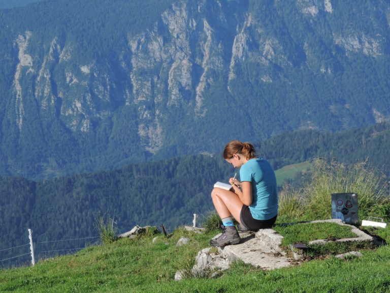
Always inform family or friends (or the hotel reception or the owners of the apartment where you’re staying) about your tour! Inform them about your planned route, potential alternative objectives, and the estimated return time. You can also leave a note with the tour details visible in your car. During the tour, enter your name in the logbooks in huts and on summits. All this will be of great help to the mountain rescue services in case of a search operation.
DURING THE TOUR
- Start slowly, at a talking pace, to warm up and prepare your body for several hours of walking. Your speed should be adjusted to the weakest member of the group –o that you can stay together until the end of the tour.
- After the first short rest (after about 15 minutes when you’ll probably want to take off some clothes), try walking for at least an hour before stopping again. Coordinate your breathing with your walking.
- Rest in spots that are as safe as possible from potential hazards (steep cliffs, falling rocks, etc) and away from the sun. Drink frequently and in small amounts, and eat energy bars or similar high-energy food. Buy food at mountain huts to reduce the weight of your backpack and support the huts. Don’t consume alcoholic beverages!
- Protect yourself from the sun with sunscreen, a hat, and sunglasses.
- Wear a helmet on paths exposed to falling rocks. Also wear it when walking over scree so that it protects your head in case of a fall. Use a climbing harness and a Via Ferrata kit on difficult and very difficult paths (where applicable).
- Turn back and return to the valley or choose a different path if you encounter an unexpected obstacle (broken steel wires, rockslide, snowfield).
- Retreat to the nearest hut or bivouac if the weather suddenly worsens. If that’s not possible, make sure to stay away from exposed ridges. Don’t continue the tour, no matter what!
GOOD TO KNOW
Almost everyone has a mobile phone nowadays, but you have to keep in mind that phones are sensitive to various factors that might go unnoticed down in the valley. Most mountainous areas have poor cell reception and phones are constantly searching for a signal, draining the battery much faster than usual. The batteries also lose power in cold temperatures.
- Charge your phone before the tour and bring an extra battery if possible. Don’t waste the phone battery unnecessarily.
- During the tour, keep your phone turned off and stored in a watertight bag kept in a warm place.
- You can save battery power by turning off mobile data.
- Make sure that your phone is turned off during the tour. If you need to, you can call 112 and 113 without entering the PIN number.
- If you’re not able to make a call, try sending a text message to 112.
- Two contacts in your phonebook should be saved in the following form: “ICE1 John Smith” and “ICE2 Mary Johnson”. These are the contacts that rescue services will call in case of an accident (ICE stands for “in case of emergency”).
The only thing you can do to protect yourself from lightning is to start your tour early enough. That way you’ll be back down in the valley or in the safety of a mountain hut by the time afternoon arrives, which is when thunderstorms are most likely to occur. These are the only safe places against lightning strikes. If you do get caught in a storm, get away from ridges and exposed summits as soon as possible, especially if there are steel wires and other metal objects nearby or if the rock is red, which indicates that it contains iron. Remove all metal items that you have with you and store them safely away. Don’t throw them away as you’ll still need them after the storm clears up. Sit on a rope or your backpack’s back panel, stick your feet in the pack, and put on extra clothing. Make yourself as small as possible. Take off your helmet if it has any metal parts.
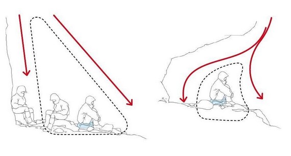
Source: Petzl
Stay clear of trees, gendarmes, and other pointed features. Don’t touch the walls as electrical current can travel quite far. The safest place of a cave or any other depression is right in the middle of it. If you’re on the edge of a ledge, it’s a good idea to use a rope to clip in (make sure that the rope runs on the ground).
Stay away from spots that show signs of regular lightning strikes. You can recognize them by split tree trunks, cracked rocks, reddish rock, etc. Wet gullies and couloirs with running water are also very dangerous. The safest places are scree slopes, where you should crouch or sit on your backpack. If you continue descending, make sure to maintain a distance of at least 20 meters between each person.
By calling 112, you’ll reach a regional notification center. It’s important to provide the operator with the following information:
- your name,
- details of the accident (what, where, and when),
- how many are injured and what are the injuries,
- the kind of help is needed.
The operator will probably ask about the weather, wind strength, etc. This information will help the intervention leader activate possible helicopter rescue and plan the rescue operation.
Recommendations how to conduct in the event of a disaster in the mountains or rescue intervention can be found in the articles In case of an accident call 112.
